

Geospatial Data Solutions for Real-Time Intelligence
Introduction to Real-Time Geospatial Data Solutions
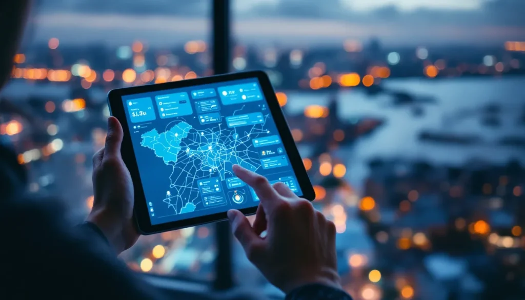
In an increasingly connected and data-driven world, real-time Geospatial data solutions have become essential for organizations seeking immediate insights and responsive decision-making. By leveraging location-based information in real time, businesses, governments, and service providers can monitor operations, predict trends, and act proactively.
These solutions integrate technologies such as geographic information systems (GIS), Internet of Things (IoT) sensors, artificial intelligence (AI), and cloud computing to provide dynamic, actionable intelligence that drives efficiency and innovation across industries.
The Importance of Real-Time Geospatial Intelligence
Rapid Decision-Making
Real-time geospatial solutions enable organizations to make fast, informed decisions. Continuous data streams from GPS devices, IoT sensors, and mobile applications provide current situational awareness, helping decision-makers respond immediately to changing conditions.
In sectors such as transportation, logistics, and emergency management, this capability reduces delays, mitigates risks, and enhances overall operational efficiency.
Enhanced Operational Efficiency
Organizations using real-time geospatial intelligence can monitor assets, optimize workflows, and streamline resource allocation. By tracking vehicles, equipment, or personnel in real time, operations can be coordinated efficiently, reducing waste and improving performance.
AI-driven geospatial solutions further enhance efficiency by predicting potential bottlenecks, automating routine tasks, and suggesting optimized strategies.
Technologies Enabling Real-Time Geospatial Solutions
Geographic Information Systems (GIS)
Modern GIS platforms form the core of real-time geospatial solutions. They integrate spatial data from multiple sources, process it dynamically, and visualize it in intuitive formats such as interactive maps and dashboards.
Advanced GIS platforms can process high volumes of real-time data, incorporate predictive analytics, and provide actionable insights for operational and strategic decision-making.
Internet of Things (IoT) Integration
IoT devices generate continuous streams of geospatial data, feeding real-time intelligence systems with up-to-date information. Sensors in vehicles, machinery, infrastructure, and mobile devices provide detailed insights into movement, usage, and environmental conditions.
When combined with AI, IoT-enabled geospatial data solutions can detect anomalies, optimize performance, and predict outcomes, transforming reactive operations into proactive management.
Cloud Computing and Data Analytics
Cloud-based geospatial platforms provide scalable storage and processing power to handle vast amounts of real-time data. Cloud computing enables seamless integration of geospatial, operational, and business datasets, facilitating analytics and visualization at scale.
AI and machine learning algorithms in the cloud analyze patterns, forecast trends, and generate real-time alerts, supporting rapid and informed decision-making.
Applications Across Industries
Transportation and Logistics
Real-time geospatial solutions revolutionize transportation and logistics by providing live tracking, route optimization, and predictive analytics. Companies can monitor fleet movements, anticipate traffic congestion, and adjust delivery schedules dynamically.
AI-enhanced geospatial data predicts delays, suggests alternate routes, and ensures efficient resource allocation, reducing costs and improving customer satisfaction.
Emergency Response and Public Safety
Emergency services rely on real-time geospatial data to respond swiftly to crises. Continuous monitoring of incidents, resource locations, and environmental conditions allows first responders to make informed decisions quickly.
Predictive geospatial models can identify high-risk zones, optimize evacuation routes, and allocate emergency personnel efficiently, saving lives and minimizing damages.
Smart Cities and Urban Management
Smart city initiatives depend on real-time geospatial intelligence for efficient urban management. Continuous monitoring of traffic, public services, energy usage, and infrastructure performance enables city planners to optimize operations and respond to issues proactively.
Predictive models analyze trends in population movement, traffic congestion, and utility consumption, helping cities plan for growth, reduce inefficiencies, and enhance the quality of life for residents.
Environmental Monitoring and Disaster Management
Environmental organizations and government agencies utilize real-time geospatial data to track climate changes, natural hazards, and environmental conditions. AI-driven analysis of live satellite imagery, sensors, and remote monitoring data enables rapid identification of risks such as floods, wildfires, or pollution events.
Real-time insights support disaster preparedness, mitigation, and response strategies, ensuring timely intervention and minimizing ecological and human impact.
Key Benefits of Real-Time Geospatial Data Solutions
Predictive and Proactive Management
Real-time geospatial intelligence allows organizations to anticipate events rather than simply react. Predictive analytics identify trends, forecast risks, and suggest optimal actions, enabling proactive management of resources and operations.
Improved Accuracy and Decision-Making
Continuous monitoring ensures that decisions are based on current, accurate data. By visualizing geospatial information dynamically, organizations can identify anomalies, understand spatial relationships, and implement informed strategies with confidence.
Enhanced Collaboration and Communication
Real-time geospatial platforms facilitate collaboration across teams, departments, and locations. Interactive dashboards and live maps allow stakeholders to share insights, monitor operations collectively, and coordinate responses efficiently.
Cost and Resource Optimization
By monitoring resources and operations in real time, organizations can reduce waste, optimize asset utilization, and allocate personnel effectively. Predictive insights from AI further improve efficiency, reducing operational costs and maximizing returns.
Emerging Trends in Real-Time Geospatial Solutions
AI-Driven Predictive Analytics
Artificial intelligence enhances real-time geospatial solutions by analyzing continuous data streams, detecting patterns, and forecasting future events. This predictive capability empowers organizations to plan proactively, prevent disruptions, and optimize operations in real time.
Integration with Autonomous Systems
Real-time geospatial data is essential for autonomous vehicles, drones, and robotics. Accurate, live location information enables these systems to navigate, respond to environmental changes, and make decisions independently, improving safety and efficiency.
Cloud-Based Platforms and Scalability
Cloud computing continues to expand the scalability of real-time geospatial solutions. Organizations can process large datasets, integrate multiple data sources, and access live analytics from anywhere, enabling rapid deployment and collaborative decision-making.
Mobile and Edge Computing Integration
The integration of mobile devices and edge computing enables real-time geospatial intelligence at the source. Data is processed closer to where it is collected, reducing latency and enhancing responsiveness for applications such as traffic management, field operations, and emergency response.
Challenges in Implementing Real-Time Geospatial Solutions
Data Quality and Reliability
High-quality, accurate data is crucial for effective real-time geospatial intelligence. Inaccurate or incomplete data can lead to faulty predictions and poor decision-making. Organizations must implement robust data validation, cleaning, and monitoring practices.
Privacy and Security Concerns
Real-time geospatial data often includes sensitive location information. Ensuring privacy, complying with regulations, and protecting against unauthorized access are essential to maintain trust and legal compliance.
Technical Complexity and Infrastructure
Real-time geospatial solutions require sophisticated technology stacks, including IoT sensors, cloud platforms, AI models, and GIS systems. Organizations must invest in infrastructure, skilled personnel, and integration capabilities to implement these solutions effectively.
Conclusion: Leveraging Real-Time Geospatial Intelligence
Real-time geospatial data solutions are transforming the way organizations operate, enabling immediate insights, predictive decision-making, and operational optimization. By integrating GIS, AI, IoT, and cloud computing, these solutions provide dynamic intelligence that drives efficiency, reduces risk, and enhances strategic planning.
Industries ranging from transportation and logistics to urban planning and environmental management are harnessing the power of real-time geospatial data to gain a competitive edge. Organizations that adopt these solutions proactively can make smarter decisions, respond swiftly to challenges, and unlock the full potential of location-based intelligence.